It is not only maps sharing
MapHub is a simple tool for sharing geo-referenced raster and vector files projected on the globe but it also allows users to collaborate over mapping work.
The project is in active development and has the following features.
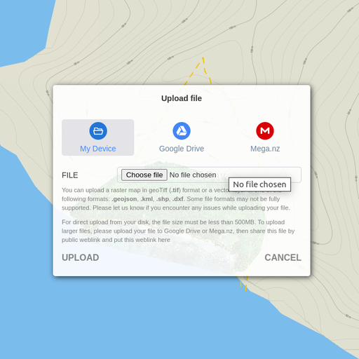
Raster files upload and display
Geo-referenced raster files in geo-TIFF format can be uploaded directly from your device or through a file share link from Google Drive or Mega cloud storage services.
Uploaded files processed and projected over the world where you can view it, do vector and digitizing work and share the results with clients and stakeholders.
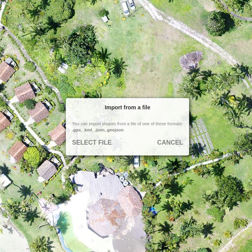
Vector files import
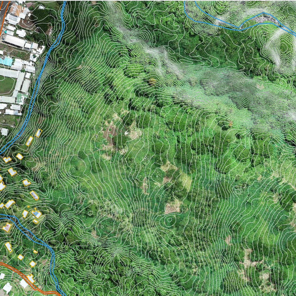
Elevation contours vector data, geospatial information, lines, position markers, polygons and various vector data can be imported as a special vector layer that laid over raster map.
Private map sharing
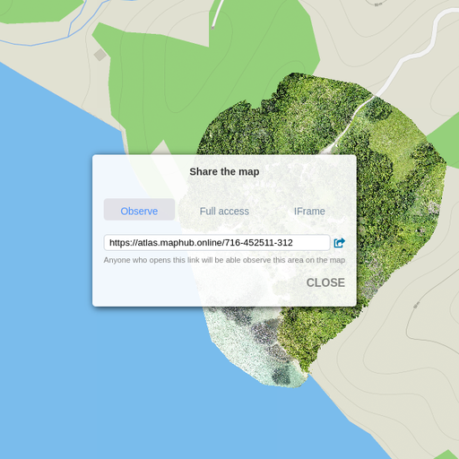
Make it public or keep it private
All maps and workspaces can be made public or kept private and shared only with certain viewers through sharing special share link.
Send a special private share link. The private share link gives access to your map to anyone who you think should see it with viewer only mode or full access for collaboration, so they could not only see, but edit it too.
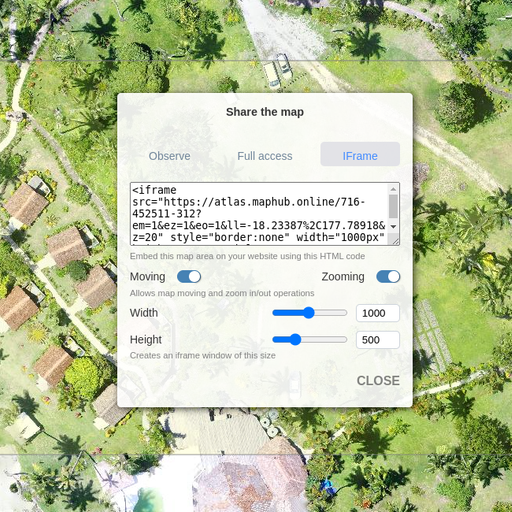
Sharing on a website
Any map or workspace can be shared online and seamlessly integrated in your website.
In the map sharing section you can get ready to use HTML code that can be simply copied and pasted in your website code.
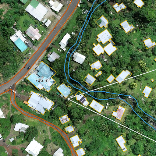
Geospatial digitizing
Once raster map is uploaded, the ground objects can be digitized, positions marked, areas and distances measured using vector tools.
Anyone who can access the map layer can create various shapes and markers over a raster map change styles and export in geoJSON format.
Great simple tool for collaborating on mapping work.
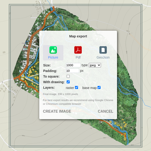
Convert and export
Raster maps and all vector work laid over them can be exported in PDF, JPEG, PNG for further processing in image processing software, used by graphic designers and creative teams.
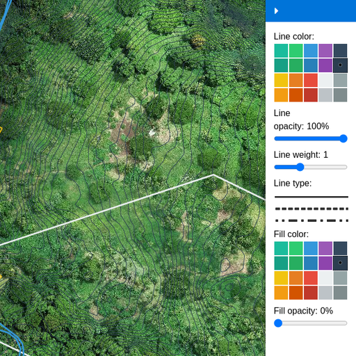
Vector style editor
Colours, line thickness and other basic styles can be changed using simple and ergonomic interface
Autocad DXF import
You can import your vector work from Autocad in DXF format to lay over the raster map or share the results of your work with clients and colleagues.